GeoMonday 2015.3 – A new dimension in Geo

Intro

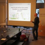
One of the most discussed topic of the recent years is the rise of UAVs, MAVs, RPVs or simply drones. These flying devices are equipped in their latest evolutions not only with full HD cameras, but also GPS devices and even small computers. This equipment is the base for next generation aerial geo-data and services. In the 3rd edition of GeoMonday we will cover the whole lifecycle from the creation, processing up to the integration for location intelligence or services. It’s a special pleasure for us to have our session for the first time in the beautiful city center of Potsdam, thanks to our Partner Zukunftsagentur Brandenburg.

Agenda:

When: Monday September 14th, 2015, starting 6pm sharp
Where: arcona Hotel am Havelufer, Zeppelinstraße 136, 14471 Potsdam

You are welcome to join our event to become part of the GeoMonday community. Get your free tickets here:
https://geomonday2015-3.eventbrite.de

We will announce our speakers in the next days and weeks, so stay tuned…

GeoMonday 2015.2 – Impressions

The second session of GeoMonday featured some amazing talks, all around services and applications that will improve the life of urban people significantly. Thanks goes to our always interested audience and to the great set of speakers:

  • Urs Fischer from ParkU demonstrated how their system helps better managing urban parking space demand
  • Christian Maertins from HaCon showcased how Beacons could be an opportunity for indoor navigation in public transportations
  • Sebastian Heise from graphmasters gave us good insights into smart traffic management
  • Henning Hollberg from Motion Intelligence presented their technology Route360°

We hope everyone of you had a great time. Below you find some impressions of our session. We hope to see you at our next event, September the 14th, in Potsdam.


GeoMonday 2015.2 – Indoor Navigation for Public Transport: The Beacon Opportunity

hacon-logo Headquartered in Hannover, Germany, HaCon creates and develops high-quality software solutions for traffic, transport and logistics. With over 30 years of experience and a dedicated team of 240+ IT and transport planning specialists, HaCon has established itself as a leading European player for planning, scheduling and information solutions.

The timetable information system HAFAS is used by transportation companies and networks all over the world. Every day, passengers in more than 25 countries place over 40 million journey planner requests that facilitate the use of public transport. Long-time HAFAS customers such as Deutsche Bahn (Germany) and SNCF (France) benefit from ever new, innovative developments for mobile applications, internet journey planners and printed timetables.

A powerful solution for train planning and capacity management, HaCon’s TPS software enjoys a growing European user base.

Christian MaertinsChristian Maertins works since of the 1990s as Carsharing, Ridesharing, eTicketing, network electric mobility consultant. 2011 he founded a StartUp to develop a multimodal Application. This app is integrated since 2014 to HaCon on Mobility Lab.

GeoMonday 2015.2 – Route360°

MI_logoThe idea of Motion Intelligence and its technology Route360° is to simplify the online search for spatial objects (local search) by the use of sophisticated route planning and travel time analysis and visualization.

Motion Intelligence provides the Technology to third party institutions and companies. Additionally Motion Intelligence offers to create concepts, develop and run applications, extend existing applications or create new ones from scratch. Motion Intelligence is specialized in travel time analysis and visualization in order to help people finding or evaluating spatial objects.

foto

Henning studied Cartography and Geomatics in Karlsruhe from 2006 until 2010 and finished with a bachelor’s degree. Since 2010 he was studying Geoinformation and Visualization at Potsdam University and received his masters degree in 2014.

In his studies he focused on the analysis of large traffic networks. The final thesis “Interaktive Analyse und Visualisierung der Erreichbarkeit in Verkehrsnetzen“ was supervised by the Institute of Geography and the Hasso-Plattner-Institut (HPI).

It recieved a lot of positive feedback and is the basis of the startup Motion Intelligence.

GeoMonday 2015.2 – smart traffic management

Graphmasters has evolved from a research team at the University of Cambridgclogo-273x273-365405
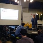
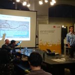
e, U.K. and King’s College London, U.K. Founders Iulian Nitescu and Christian Brüggemann started with a research project on efficient routing algorithms in large graphs about 5 years ago. In 2011 Sebastian Heise, as a senior system architect, joined the team and the research project evolved to a product, so as the team evolved to a company. In February 2013 the Graphmasters GmbH was officially founded and counted three members. After a long phase of evaluations from major navigation system providers, we were able to incorporate our routing engine into existing the navigation systems such as BOSCH. Today, we count 11 team members in two offices. Hanover, Germany is the place where product development and testing happens. Robert Dohrendorf complements the management team as experienced MBA in international business. Graphmasters provides apps and services to solve traffic management issues for smart cities and optimize trips for CEP services and logistic industries.

cap gemini portraits

Sebastian Heise

Sebastian is a pioneer and tech entrepreneur with a strong research and computer science background. In 2004 he started studies in computer science and media technology in Bremen, Germany. He published numerous scientific papers in the field of audio analysis, image processing and human machine interaction. He holds a master’s degree in computer science for his work on hearing aid fitting at Fraunhofer IDMT. His work on audio analysis and pattern recognition gained international attraction in the audio community and led to several tech companies. At Capgemini, he was involved in AAA projects in the automotive industry as well as in the energy sector. With Team-Greenway he made it to the top rated team in the Microsoft Imagine Grant 2012/13. Today Sebastian is co-founder of Graphmasters and leading the development team in Germany. As a future-looking visionary, he is making high-end technology accessible to everyone.

GeoMonday 2015.2 – Managing urban parking space demand

Parking spaces are a highly sought-after and often rare, expensive and non-reservable commodity, which results in frustrated car drivers, waste of resources, environmental pollution and increased traffic density. Still inner city parking spaces are often not fully utilized due to limited access or because drivers are simply unaware of their existence. Urs Fischer presents an innovative parking solution for urban areas: parking space sharing. parku gives private persons as well as companies, shops, hotels and even professional parking operators a free platform to advertise their temporarily unused parking spaces, with the option to define availabilities of spaces as well as setting their own fees. Drivers can easily find the nearest parking space by using the parku app or by visiting the website. Here, they can either book their spot well in advance or spontaneously whilst already on the road. Moreover, parku’s SESAME technology enables drivers to easily open barriers and gates by scanning a QR code.

parkU_004

Urs Fischer

  • Has several years’ work experience at the Bertelsmann AG (Business Development Manager, Director New Media, Executive Assistant to the CEO and President)
  • Master of Science with Distinction (Grenoble Graduate School of Business, France) Bachelor of Science in International Business (Maastricht University, Netherlands)
  • In addition to German as a mother tongue German he speaks English, Dutch and French fluently

GeoMonday 2015.2 – Geo Services for Smarter Cities

Intro

What are smart cities? In this session our speakers will provide you with an overview of concepts, that combine geolocation technologies and urban demands in a new way. As the designated center of e-Mobility in Germany, Berlin plays an important role of an icon how smart cities could be established. There are plenty more or less experimental initiatives out there and we are keen to shade some light on what it’s all about and how it could improve the live quality of Millions of people going forward.

Agenda:

When: Monday June 15th, 2015, starting 7pm sharp
Where: Mobilesuite, Pappelallee 78/79, 10437 Berlin

You are welcome to join our event to become part of the GeoMonday community. Get your free tickets here:
https://geomonday2015-2.eventbrite.com

We will announce our speakers in the next days and weeks, so stay tuned…

GeoMonday 2015.1 – Impressions

April 13th we kicked off GeoMonday 2015. For those who where not present, here are some pictures illustrating the talks about our 1st event with the headline Navigation and Orientation for Handicapped People.

Thanks again to our Guest and Speakers:

  • Holger Dieterich (with Raul Krauthausen) from SOZIALHELDEN talked about wheelmap and brokenlifts
  • Marc Ullrich from mdv explained the Projekt SIMBA, how to Barrier-Free routing for Handicapped Persons with using OSM Data
  • Manuel J. Kripp from m4guide  talked about multi modal mobile mobility guide for visual impaired people

We saw some great talks and also got to insides into several social projects that improve barrier-free routing for handycapped people. We really encourage to get in contact with our speakers as they all have a great story to tell.


GeoMonday 2015.1 – Does this place have stairs at the entry?

Holger and Raul, who is using a wheelchair, had to ask this question a lot when they wanted to go somewhere. So they build Wheelmap.org, a map to find wheelchair accessible places. Since it’s launch 5 years ago over 500.000 places have been tagged by volunteers all over the world, making it the biggest database of it’s kind. Wheelmap.org is online in 22 languages and also available as iOS and Android apps. Being an OpenStreetMap project all it’s data is available under an open license. Wheelmap.org is run by SOZIALHELDEN, a non-profit based in Berlin which launched many follow-up project since then. One is the service BrokenLifts.org where visitors can see which elevators are currently out of service in the Berlin public transportation system.

Holger is the co-founder of Wheelmap.org and will tell us about the opportunities and challenges they saw when building these projects on top of open data, what things they tried and failed and how he sees projects like these in the long run.

About Holger Dieterich
When Holger is not at SOZIALHELDEN, he is active in the Berlin Startup scene as coach and mentor for entrepreneurs, curator of the StartupDigest and running events like the Lean Startup Meetup and Usabilityfix. He has a degree from the University of the Arts Berlin and worked as product manager before.

Associated Links:
http://wheelmap.org
http://brokenlifts.org
http://sozialhelden.de
http://holger-dieterich.de/

GeoMonday 2015.1 – Navigation and Orientation for Handicapped People

Intro

Navigation devices have dramatically changed the way we drive. Systems are so easy to use, you could say we are dependable. However there are a lot of people out there, which have physical limitations and have real dependencies. This GeoMonday want to shade some light into clever solutions, that help those people everyday.

Agenda:

When: Monday April 13th, 2015, starting 7pm sharp
Where: Mobilesuite, Pappelallee 78/79, 10437 Berlin

You are interested in getting to know some great ideas on this topic and discuss them with us, or even have your own Projects helping to improve every day situations for people with limitations? Join our event and get part of the GeoMonday community.

Get your free tickets here: https://geomonday2015-1.eventbrite.com


If you have your own idea you want to share with others just send us an e-mail to info@geomonday.org. We still have some free slots for the event and are grateful for every contribution. Also see our other events for 2015.