GeoMonday 2015.4 – Impressions

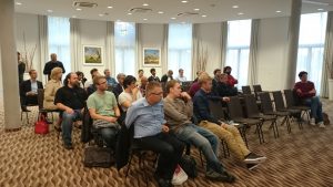
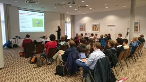
The last session of GeoMonday 2015 was again a supreme gathering of geo-addicted tech people and a set of fantastic speakers. We had a last minute commitment from Gabriele Negro (kietsy). He joined the presentation canon as the 4th speaker. The session was kicked of by Maximilian von Garnier (Yelp), followed by David Yu (Scoped.co) and Robert Tochman-Szewc (Jodel).

It was interesting to see, how much messaging, advertisement and place discovery nowadays seamlessly blend together and that often the related spatial content is not anymore associated with a map view.

For those who missed the session, here some videos of our speakers:

And some presentations:

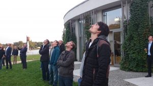
Finally here some impressions: https://www.flickr.com//photos/136953217@N03/sets/72157662508315585/

We wish all presenters, guests and followers of GeoMonday a merry christmas and a happy new year. Please bear with us, as we are coming back in 2016.

PS: Have also a look into our newly planned head organization and consider becoming part of it: http://geoit.org


GeoMonday 2015.4 – Jodel and Location

The presentation will introduce you to Jodel, a student-targeted location-based communication platform, show the role of location in the product and how the company went through different solutions to keep a consistent user experience without sacrificing performance.


After finishing his Master’s Thesis about Brand Analysis on Reddit, Robert Tochman-Szewc joined Jodel as a Business Intelligence developer and analyst. There, he was in charge of creating a location-focused warehouse solution for the company, a key part of the company’s analytics stack. Later, he continued reworking the application backend and is currently Tech Lead at the company. He has previously worked at SAP in different departments during his Bachelor studies.

GeoMonday 2015.4 – Scoped.co – Shortening the Distance in Local Search

Yelp, Foursquare, and many others have paved the way for consumers and local businesses to interact with each other.  These services give context to the eternal question “Where should I go?”  In this session, Scoped.co founder David Yu will talk about how to “shorten the distance” between a user and what they want.  For example, how does one answer the question “What handbags are available close to me?”  David will describe some of the data, search and recommendation problems he has worked on, and how Scoped plans to take local search one step further, not only to help consumers find what they want, but also to empower brick and mortar businesses.

* Data science is not a buzz word – examples from Bioinformatics and Goodreads
* Personalized search – Scoped.co Demo #1
* Defining the data topology for the physical world
* What can we do with data? – Scoped.co Demo #2


David Yu is a serial entrepreneur.  His first company Discovereads was acquired by Goodreads/Amazon, and the technology currently powers book discovery for more than 50 million users world wide.  He also worked as the CTO of Q Digital, a media company with 10 million MAUs.  Scoped is his third company.  David double-majored in computer science and molecular biophysics at Yale University, and received his JD degree from Harvard Law School.  Before becoming an entrepreneur, David worked for Genentech’s Bioinformatics department, using computer algorithms to find potential drug targets.  In his spare time, David enjoys skiing, playing the cello, and going to rock and classical concerts.

GeoMonday 2015.4 – Yelp – The Power of User Generated Content

The consumer voice online is stronger than ever. With the influx of social media, mobile purchasing, social sharing and reviewing, there is nowhere for businesses to hide when it comes to customer comments. Consumers love to share their thoughts and feelings about great businesses. So what happens when something goes right or wrong? They write a review online of course! Online community and review site Yelp now attracts over 89 million unique visitors per month coming from mobile devices alone, with 90 million reviews submitted to the site in total. So with that in mind, this session will address:

• Yelp – Fact & Metrics
• Attributes on Business Listings (Business & User generated)
• Yelp’s Recommendation Software
• Yelp’s API
• Careers @ Yelp

Maximilian von Garnier is Yelp’s Manager of Local Business Outreach for Germany. He hosts informational sessions with local business owners across Germany to educate them on best practices for navigating the world of online reviews. He works with Yelp’s Small Business Advisory Council, and delivers constructive feedback from the business community to the different division within Yelp. He also hosts a series of webinars about Yelp’s free online tools, and regularly produces informative content for Yelp’s “Blog for Business Owners”. Prior to joining Yelp in 2014, Max worked for AOL Germany as an Editorial & Video Production Manager for ten years. He was born in Berlin and now lives in Hamburg. For six years he was the head coach of the Hamburg Blue Devils (American Football).


GeoMonday 2015.4 – Experience your places

Intro

Everyday we are crossing plenty of streets with hundreds of interesting places. Each of them have their own story. Once we want to capture them in the digital space it’s a tremendous effort to harmonize all those individual attributes.
This 4th and last GeoMonday in 2015 covers the lifecycle of place data capturing, aggregation and integration in products.

Agenda:

When: Monday December 7th, 2015, starting 7pm sharp
Where: Mobilesuite, Pappelallee 78/79, 10437 Berlin

You are welcome to join our event to become part of the GeoMonday community. Get your free tickets here:
https://geomonday2015-4.eventbrite.de

We will announce our speakers in the next days and weeks, so stay tuned…

GeoMonday 2015.3 – Impressions

Hosted at the scenic location in the center of Potsdam, close to the river Havel, this 3rd GeoMonday turned out to be a really nice occasion for all drone enthusiasts. Our first outdoor hands on session was blessed with rays of sunlight from a Indian summer sun.

Thanks again to the interested audience and to all of our fantastic speakers.


The session was kicked-off with the live data collection session using a smart drone, presented by Arno Fischer,  professor at the University of Applied Sciences Brandenburg.

Here is the spectacular video from our session ground:

[slideshare id=53239265&doc=fhbgeomonday-2015-potsdam-150927082750-lva1-app6891]


Immediately afterwards Frank Neitzel, professor at the Technical University (TU) Berlin, told us how to build a drone from very affordable components and get the system working.


Our third speaker of the evening was Martin Scholl. In his presentation he gave insights of a project equal to OpenStreetMap, the OpenAerialMap in order to create aerial views of the world:

[slideshare id=52780124&doc=201509geomonday2-150915020313-lva1-app6892]


The closing session was held by Christian Janke, Research Engineer at the European Aviation Security
Center (EASC)
 in Germany. He spoke about the chances and challenges of unmanned aviation.

[slideshare id=53238892&doc=cjgeomonday140915short-150927080011-lva1-app6891]


GeoMonday 2015.3 – Speakers, venue and transport information

As our next event at the 14th of September is soon to kick-off, here for your the complete list of speakers for GeoMonday 2015.3 – A new dimension in Geo:

Martin Scholl: Capturing the world in 3D: beyond OpenStreetMap
Christian Janke: Chances & challenges of unmanned aviation
Frank Neitzel: Mobile 3D Mapping with a Low-Cost UAV System
Arno Fischer: A practical guide to use drones

Please remember we start this time at 6PM, as we planned for a live hands-on session into unmanned aerial vehicles (UAVs) before the talks will start. Also this time we enjoy to have our event in the wonderful city of Potsdam, located south-west at the gates of Berlin. The address is:

arcona Hotel am Havelufer
Zeppelinstraße 136
14471 Potsdam

A possible route is available here:

https://www.google.com/maps/dir/Mitte/arcona+Hotel+am+Havelufer,+Zeppelinstraße+136,+14471+Potsdam/@52.4610203,13.1363902,12z/data=!3m1!4b1!4m18!4m17!1m5!1m1!1s0x47a851dd8abc4201:0x52120465b5fabc0!2m2!1d13.3830683!2d52.5306438!1m5!1m1!1s0x47a8f4357f4f7fa1:0x3953a63584cb8ac7!2m2!1d13.0335271!2d52.3907463!2m3!6e0!7e2!8j1444842000!3e3

For those who haven’t got there free tickets yet, here is your link:

https://geomonday2015-3.eventbrite.de

GeoMonday 2015.3 – A practical guide to use drones

fhb_logo_neuIn this presentation it is shown a complete workflow for 3D-Reconstruction using a civil drone and getting structure-from-motion (SFM) technologies. Security issues and legal aspects are also considered.

The following questions and actions are discussed and
performed:

  • what is the minimum set for a drone mission (Hardware and Software Requirements)
  • basics for flying a drone, Safety and Security and legal aspects
  • basics to prepare an autonomous flight
  • concrete steps to prepare and fly the mission
  • how to process the data (image data)
    • e.g. how to get still images from a video stream and more
  • practical aspects about photogrammetry, especially stereo photogrammetry
  • define the workflow for 3D reconstruction using commercial software.

Fischer-mit-Drohne
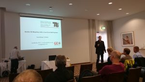
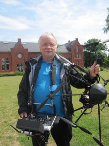
Arno Fischer is a Professor for Operating Systems and Computer Networks at the University of Applied Sciences Brandenburg (FHB). He has been working on drone technologies: Anticollision Systems (Detect and Avoid), Attitude Control, Safety and Security for Drones, Civil Applications and Use Cases with Drones and Teaching Concepts. On Behalf of FHB he is member of UAV-DACH and DIN (NA 131-01-01 AA Arbeitsausschuss Unbemannte Luftfahrtsysteme).

GeoMonday 2015.3 – Mobile 3D Mapping with a Low-Cost UAV System

TU_Logo_lang_RGB_rotIn this presentation it is shown how an UAV system can be built at low costs. The components of the system, the equipment as well as the control software are presented. The main focus of this presentation is on the generation of 3D point clouds from digital imagery. For this web services and free software solutions are presented which automatically generate 3D point clouds from arbitrary image configurations. Possibilities of georeferencing are described whereas the achieved accuracy has been determined. The presented workflow is finally used for the acquisition of 3D geodata. On the example of a landfill survey it is shown that marketable products can be derived using a low-cost UAV. At the end of the presentation the latest trends in the UAV market are presented.

Neitzel
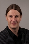
Frank Neitzel is a Professor for Geo-IT and Geodesy at the Technical University (TU) Berlin. He has a lot of experience in building affordable drones for 3D Geo-data collection and already published related papers.
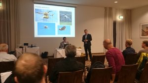
GeoMonday 2015.3 – Chances & challenges of unmanned aviation


Chances:
The drone industry is diverse, innovative and international. It has an enormous potential for growth with the associated possibility to create jobs.  Today there is a fast-developing community that uses Unmanned Systems in general or RPAS in specific, for multiple applications. Some examples are: precision agriculture, infrastructure inspection, wind energy monitoring, pipeline and power inspection, highway monitoring, natural resources monitoring, environmental compliance checking, atmospheric research, media and entertainment, sporting event photography, filming, wildlife protection and research, hunting and anti-hunting monitoring and disaster relief (EASA CONOPS, 2015).In EASA countries there are 2495 operators and 114 RPAS manufacturers. They produce and operate RPAS from very small to medium sizes with a maximum take-off mass (MTOM) below 150kg (EASA CONOPS, 2015).
Worldwide there are different levels of freedom for UAS/RPAS, ranging from complete prohibition to full integration in low-airspace beyond-visual-line-of-sight.

Challenges:
Due to recent reports about different events, the topic of civil use and misuse of unmanned aircraft systems (UAS) is gaining attention. Other terms are „RPAS” – Remotely Piloted Aircraft Systems or plainly “drones”.Especially small UAS (sUAS) are easy to obtain (self-made or purchase), easy to operate and very mobile (vehicle and remote control are portable). sUAS can be fixed-wing, quad-or multicopter, propelled by electric or piston engine and piloted remotely or automatically.Furthermore sUAS are difficult to detect and counteract. Performance and payload capabilities of modern sUAS are raising the question of a possible misuse.
Current and present examples are various, from the disruption of international soccer games, secret observation of French nuclear power plants, smuggling of contraband into prisons to the increasing use of UAS for espionage and intrusion of privacy.
Possible threat scenarios show even more hazardous possibilities of unlawful interference through crime and terrorism. Equipped with a respective payload sUAS can travel the appropriate distance to enter secured areas or perimeters. In this domain of Safety and Security considerations, it is necessary to focus on feasible detection methods against misuse or adversary UAS.

Christian Janke is currently a Research Engineer at the European Aviation Security unnamedCenter
 (EASC) in Germany. His R&D focus is on Unmanned Aircraft Systems, technology impact assessment in context of legal frameworks and stakeholders. He is currently promoting Unmanned Aviation, like UAV DACH and UVS International in close cooperation with national and international associations. Aim of this engagement is facilitating broad civilian UAS applications by addressing questions like weight classes, visibility minima or insurance context.