GeoMonday meets LBMA – Komoot presentation material

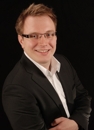
Once again we had the pleasure to have Markus Hallermann on the stage. The CEO of komoot gave amazing insides in how the start-up transformed into a profitable company, challenges finding the right business models and of course the pretty tricky bit to market your app.

Connect with him:
Markus Hallermann
CEO of komoot
www.komoot.de
@walsertal

[slideshare id=27937315&doc=geomondaykomoot-131105143930-phpapp02]

GeoMonday the 1st – Talk 3: Turn-by-Turn Navigation and Rich Information for Outdoor Activities (presentation material)

Markus Hallermann helped us to understand, for outdoor activities like cycling, hiking, road or mountain biking the user needs a lot of different information to choose the best fitting or better the most beautiful route for his activity.

Connect with him:
Markus Hallermann
CEO of komoot
www.komoot.de
@walsertal

[youtube=http://youtu.be/U3G9dvzknt8]

GeoMonday the 1st – Talk 1: Smart Coordinates (presentation material)

Martin Soutschek was our first speaker at GeoMonday the 1st. He talked about the broad area regarding outdoor & touristic mapping and related geo services.

Connect with him:
Martin Soutschek
Research & Development ALPSTEIN Tourismus GmbH & Co.KG
www.alpstein-tourismus.com
@Soutschek
martin.soutschek[at]alpstein.com

[slideshare id=20739827&doc=130429-smart-coordinates-geomonday-slideshare-130507115439-phpapp02]

[youtube=http://youtu.be/Ht2f6D02M3M]

Talk 3: Turn-by-Turn Navigation and Rich Information for Outdoor Activities

Markus HallermannFor outdoor activities like cycling, hiking, road or mountain biking the user needs a lot of different information to choose the best fitting or better the most beautiful route for his activity. Smart phones provide the hardware for true turn-by-turn navigation.

In this talk Markus Hallermann will discuss the challenges of maps and the rich information the user demands planning and navigating a outdoor route.

Grown up in Austria and with a background in physics Markus is CEO and co-founder of komoot.

Follow him on Twitter: @walsertal

Talk 2: ReiterApp – Topographic orientation and the importance of maps

wilkenholle Our 2nd talk is really special. Wilken Holle will speak about maps for horse riders:

Especially in community of horse riders a different map usage is widespread. Conventional maps on Smartphone cannot be used due to the lack of important details. Small paths, stairs or poisonous plants are some of the factors that play an important role for the orientation in the terrain. The orientation feature of the ReiterApp is intended to help finding the best route. Or the fastest. Or the safest. Or the most beautiful…

iphone-screen-orientierung  Follow him on Twitter: @wilkenholle

Talk 1: Smart Coordinates – The underlying magic for a new age of outdoor & tourism maps

ImageMartin Soutschek is our first speaker at GeoMonday the 1st, who is coming from the beautiful Alpine area south of Germany. He is Head of Research & Development at ALPSTEIN Tourismus GmbH & Co.KG. For more than ten years, he has been engaged with geo technology in the area of Location Based Services (LBS) and earth viewer platforms.

His talk will cover the broad area regarding outdoor & touristic mapping and related geo services.

Follow him on Twitter: @Soutschek