GeoMonday 2016.2 – swarm bee location-awareness technology

To support location-awareness independent of satellite navigation nanotron has created the swarm bee family of wireless modules. Modules are available with Chirp or UWB radio technology. All of them are sharing the common swarm API. The swarm product family targets the growing market for autonomous smart items and cuts time to market for location-aware products by 12 months. With swarm bee developers focus on application design. The talk describes the basic swarm bee module configuration and explains use cases and business applications.

Dr. Thomas Foerste, VP Marketing & Sales nanotron Technologies GmbH, Berlin (Germany) joined nanotron in 2008 from LSI. Previously senior sales and marketing positions with LSI, AT&T, Lucent Technologies and Agere Systems. Ph.D. in Semiconductor Devices from Technical University Dresden, Germany.

GeoMonday 2016.2 – A fresh look at indoor location

TraceWave has developed a new technology for indoor location without any infrastructure. Our radio nodes measure distance and direction between them. This works both indoors and outdoors, with only two nodes but also with multiple nodes.  This is a completely new concept, called relative location. If there are more than two nodes, they will work together and create a mesh network. If one or more nodes is fixed and has known coordinates than all nodes can deduce their own coordinates, this is called absolute location. If one or more nodes has GPS coordinates, all nodes can deduce their own GPS coordinates from that, even when they are inside a building. This is called geo-location. So, our technology can provide indoor-GPS functionality. The core of our radio nodes is a low-power 2.4 GHz or 5.8 GHz radio transceiver. Our radio signals are different from WiFi or Bluetooth, because they specifically designed for distance and direction measurement. The radio easily can be implemented as an integrated circuit and will fit in e.g. a watch, bracelet, ID badge or tag. We currently are finalizing our prototype, an FPGA-based software defined radio.

Corné van Puijenbroek is a serial entrepreneur and has 30 years of experience in high-tech wireless development. After working at NXP, Ericsson (DECT) and Lucent/AT&T (WiFi) he was CTO of Adcon in Austria, (ZigBee). In 2005 was co- founder and CTO of GreenPeak, a ZigBee company, acquired in 2016 by Qorvo. Corné also was CTO and VP at several startups, in the area of LTE, solar and low- power wireless. He is (co )author of 13 patents. Corné is co-founder and CEO of TraceWave GmbH.

GeoMonday 2016.2 – Hyper-Accurate Mobile Geolocation Apps

faLocation awareness is definitely one of the killer features of smartphones and it is a driver for innovation for many years now. And still building a high quality location based app is one of the most challenging tasks. This talk shares experiences in how to build a location-based mobile app fulfilling extraordinary demands in accuracy, reliability and power consumption at the same time. It will cover obstacles solved during 3 years of developing Familonet’s next-generation hyper accurate geofencing technology including some specifics of the location APIs of iOS and Android. In addition this talk will give an outlook for use-cases of location services and geofencing in particular.
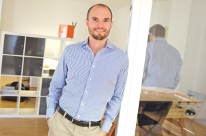
familonet_portraits_derkevin.com_kevinmcelvaney 7David Nellessen is co-founder and CTO of Familonet, a Hamburg-based start-up which has developed a mobile app for secure communication within families. Born and grown up in Münster, he studied mathematics at Freiburg University, focusing on Quaternionic-Kähler Geometry. At that time, he ran an agency for web development. After graduating with a diploma degree in mathematics and economics, he looked for new business models for product development and, together with Hauke Windmüller and Michael Asshauer, co-founded Familonet, a start-up that now has over a million users worldwide.

GeoMonday 2016.2 – Low-cost Outdoor and Indoor Asset Tracking

Here logoTracking Solutions consist of many different ingredients: low-cost and
power-efficient tracking hardware, accurate outdoor and indoor
positioning technology, secure device and account management as well
as advanced geo-visualization and analytics tools. I’ll present
concrete end-to-end tracking implementations based on HERE’s
geo-services and talk about our learnings so far.


Hannes KruppaHannes Kruppa manages the software and hardware R&D team at HERE which
brings HERE’s geo-location services to the Internet of Things. He
holds a PhD in Computer Science and has previously conducted research
at ETH Zurich, IBM and Carnegie-Mellon.

GeoMonday 2016.2 – Geo-Tracking

The economy of the 21th century is heavily relying on goods and people travelling around the globe in less than a day. For seamless processing, accuracy of tracking is as important as punctuality. But there is even more then just logistics. The second GeoMonday 2016 will cover the entire range of tracking, starting from the infrastructure of sensors and beacons to the solution business which helps applying business intelligence for any transportation vehicle.

Get your tickets for the 2nd GeoMonday 2016 now!

Date: 20th of June 2016
Time: 7 pm
Place: 
MobileSuite – Pappelallee 78/79 – 10437 Berlin – Germany

GeoMonday 2016.1 – Impressions

A big thank you again to all the speakers and also to the audience. It was a great start into 2016 as another year full of interesting Geo-Topics.

For everyone who could not be there or would like to recall some information, we will publish the slideshows and the video very soon.

We are looking forward to seeing you on the next GeoMonday, the 20th of June. Keep checking this blog for updates.


GeoMonday 2016.1 – Prof. Dr. Asche – Pedestrian Navigation

Anyone autonomously moving in geospace is a pedestrian. This term denotes a large but heterogenous collective unified by similar strategies and speed of movement. Pedestrian navigation typically is an outdoor activity in public space.

It is a banality that pedestrians do not move and navigate like motor vehicles. Yet to date, geospatial data and navigation systems to assist pedestrian orientation and movement are mainly based on car navigation data. Media to support movement and navigation of pedestrians effectively, however, require geospatial data tailored to the specific albeit diverse requirements of the targeted audience.

In a feasibility study, a team of geoinformation and social scientists of Potsdam and Saarbruecken have assessed the status quo of existing data for pedestrian navigation and developed strategies to create and maintain a geospatial data base for pedestrians.

Asche_Bild_grau

Hartmut Asche is a professor of geoinformation science at Potsdam university. His research foci include data acquisition, management and services for orientation and navigation in geospatial environments.

GeoMonday 2016.1 – MindTags – Inclusion via technology

ATT00001

MindTags makes digital accessibility in everyday life tangible and opens up new experiences for everyone. Using a smartphone, our system makes it possible to access information, adapted for user-specific needs.

MindTags is designed according to the principles of universal design and is optimized to be used by people with disabilities.

Cultural and educational institutions, public buildings as well as businesses can provide current and location-based information to their visitors and staff using MindTags. We also offer orientation in open and closed spaces and make them accessible to everyone.

GeoMonday 2016.1 – MotionTag – Sensor data based mobility


mtag
Understanding how people move is key to optimizing transport services. While the mobility market is facing huge dynamics, little has changed in the methods to measure performance and usage of individual services. Current transport analytics are still conducted with phone interviews and online forms.

MotionTag instead uses smartphone sensor data and machine learning to determine how, when and where people travel. Furthermore we use that data to paint a holistic picture of people’s mobility. Our talk will discuss different steps and problems concerning the process from recording smartphone sensor data to putting identified trips on a map. Therefore we compare our approach to related work in this field of study and present an extract.

Your presenter: Florian Stock, MotionTag

MotionTag creates services from motion data. Our app automatically detects 9 different transport means and gives new insights into people’s mobility behavior. Our vision is to enable seamless travelling with Be-In/Be-Out ticketing. We dream of a world where people access public transport without having to deal with tariff zones, ticket machines or change. A person just enters a subway, a train or even a carsharing vehicle and travels from A to B while the smartphone takes care of the billing.

Florian Stock_2.jpg
Florian studied Mathematics at the TU Berlin and the CSIRO in Melbourne, Australia.
Since November 2015 he is a co-founder and the CTO of MotionTag.

GeoMonday 2016.1 – Esri – Campus Navigator: Guiding your visitors seamlessly indoor and outdoor

EsriDeutschland

People spend the majority of their time indoors, be it in their office, in malls, airports or train stations. The geospatial industry has meanwhile reacted with a plethora of approaches. Unfortunately, most of them neglect the fact the people are moving indoors AND outdoors. Together with our friends from Munich based startup NavVis we have developed the Campus Navigator, a solution that provides its users with a seamless indoor and outdoor experience.

Your presenters: Alexander Erbe and Lars Schmitz, Esri Germany

Esri inspires and enables people to positively impact the future through a deeper, geographic understanding of the changing world around them. Esri develops geographic information systems (GIS) that function as an integral component in nearly every type of organization. Check out Esri’s developer portal for free developer subscriptions. Read Esri’s developer blog.

Lars Schmitz klein


Lars has been a Project Manager, Product Manager and for the last 3 years has been leading Esri’s German initiative to collaborate with startups to unlock innovation potential. Find his LinkedIn profile.


Alex


Alex has studied computer science and has been a Product Specialist and developer at Esri Germany for almost ten years now.