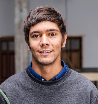
Maps are more than just conveyors of geographic information. Maps can tell stories and – given their purpose and use – this is reflected in their appearance. In the digital world, map design goes well beyond the design of the base map, polygons and marker icons. It involves creating an entire experience beyond the borders of the map container and includes UI elements as well as data. Digital map design needs to accomodate very different use cases. Great experiences give context to a map, help to convey the most important information effectively and increase its usability. They are also more fun. So what are we waiting for? In his talk, Alsino Skowronnek (@alsinosko), will stress the importance of map experience design and present a selection of his own work.
Alsino Skowronnek is a Berlin-based freelance interface designer and  maker of visual things. A geographer by training in his earlier life, he has worked for different organizations around the world, most often somewhere between spreadsheets, maps and policy. Amongst others, he has worked for the OECD in Paris and Statista GmbH in Hamburg. For his work on airbnbvsberlin.de he was nominated for the Grimme Online Award, the “Information is Beautiful Award” and the Designpreis Brandenburg.
 ammetry has been around for over 150 years and its first and foremost usage was measurements and cartography. With the reinvention of structure from motion algorithms and the immense increase in computation power new potential got unlocked. With the automated extraction of 3D data meshes can be created automatically and the images can be mapped on the 3D surface. Digital Maps already transition to full 3D reconstructions. The recent developments not only have an impact on the Geospatial Industry, but also in other fields. Image mapped 3D reconstructions have a high visual fidelity and because of this get used more and more visual effects and very recently videogames. With VR the potential further increases as VR makes you feel like you are there. Feeling fully present in a 3D scene makes reconstructions of the real world incredibly interesting as you essentially “teleport” to a different place. The huge importance of this is emphasized by the fact that Facebooks interest in VR is essentially to create a teleporter.
 he gained profound knowledge in 3D Reconstruction through LiDAR Scanning, UAV and Ground Photogrammetry. Driven by the question how to unlock the potential of the gathered data for public relations and museum context he started to look into realtime 3D graphics and eventually VR HMDs for visualization. Amazed by all the possibilities for scene reconstructions and VR HMDs for Archeology and beyond he founded
 and Economics. Human-Computer-Interaction in virtual realities has been a core interest of Robert Meyer for years. The current thematic complex is based on the transition of game technology in business and industry applications. Robert Meyer is not only a developer but also has contributed to numerous scientific conceptions within this field.
 group of the Hasso Plattner Institute at the University of Potsdam, Germany. He has many years of experience in the development of complex processing, analysis, and visualization techniques for massive point clouds. His main focus are research and industrial IT solutions for the management and application of large-scale, highly detailed point clouds.