GeoMonday the 1st – Talk 3: Turn-by-Turn Navigation and Rich Information for Outdoor Activities (presentation material)

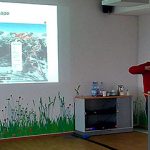
Markus Hallermann helped us to understand, for outdoor activities like cycling, hiking, road or mountain biking the user needs a lot of different information to choose the best fitting or better the most beautiful route for his activity.

Connect with him:
Markus Hallermann
CEO of komoot
www.komoot.de
@walsertal

[youtube=http://youtu.be/U3G9dvzknt8]

GeoMonday the 1st – Talk 2: ReiterApp (presentation material)

Wilken Holle spoke beside his other projects about the challenges to create a map application for horse riders.

Connect with him:
Wilken Holle
CEO of out there! communication
www.othere.de
@wilkenholle
wilken.holle[at]othere.de

[slideshare id=20717244&doc=ot-reiterapp-geomonday-130507041206-phpapp01]

[youtube=http://youtu.be/-MQtf_xtbo4]

GeoMonday the 1st – Talk 1: Smart Coordinates (presentation material)

Martin Soutschek was our first speaker at GeoMonday the 1st. He talked about the broad area regarding outdoor & touristic mapping and related geo services.

Connect with him:
Martin Soutschek
Research & Development ALPSTEIN Tourismus GmbH & Co.KG
www.alpstein-tourismus.com
@Soutschek
martin.soutschek[at]alpstein.com

[slideshare id=20739827&doc=130429-smart-coordinates-geomonday-slideshare-130507115439-phpapp02]

[youtube=http://youtu.be/Ht2f6D02M3M]

GeoMonday the 1st – Event Review

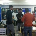
Woooah, what a day – precisely evening! What started pretty calm 6:30pm at Nokia House Berlin became really great. We were excited to see more than 50 participants showing up and enjoying  the venue featuring a great view over Berlin. The initial kickoff was given 7:30pm by a little introduction from our GeoMonday team. After this little warm up everyone had the pleasure to not only watch 4 interesting talks, but also get involved with the speakers afterwards. Topics went from smart location data to horse riders maps, difficulties of outdoor guidance and the challenge to gather and process community data. After the official part around 2 dozen people stood to further discuss and get connected.

It was an absolutely amazing session and I wanna say: Thank you to all who helped making that happen! Seeing people coming from universities, start-ups or those who want to create one, up to small and medium sized enterprises convinced us, that GeoMonday is the right platform for all the GeoGeeks around to stay up-to-date and get connected.

In order to make the event better next time we requested for feedback and we got it 🙂 Out of 13 feedback forms we got that average data:

  • How much did you like the event location? 4.6 out of 5
  • How much did you enjoy our talks? 3.9 out of 5
  • Did you like the scheduling? Date / Time? 4.2 out of 5
  • How likely would you promote that event to your friend, colleagues, etc.? 4.2 out of 5

With such an amazing feedback we are strongly encourage to continue. We got also good input from the free text form:

  • Please make the talks shorter! > Good point, we go probably for a 10min time talk next time
  • Please present the speaker and include their contact details in the presentation > Yes, absolutely!
  • Provide pizza > Well, let’s see 😉

So thanks for those who gave feedback. We are happy to hear your words also later on, via info@geomonday.org or via our Twitter Channel https://twitter.com/GeoMonday.

As one thing is for sure, there is no great stats blog without a map. So here is ours. It shows the visitors in our Update Blog since it got launched:

Visitors_Map

Last, but not least here are some visual impressions from the event itself. We really hope next time we have another great session and welcome you!