Sidonia Ilie

Sidonia Ilie

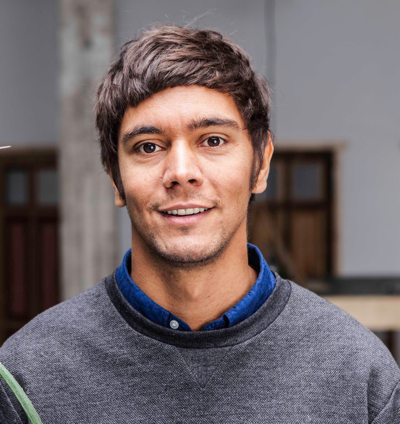
Is a Solution Engineer with Esri Germany. She has a background of Surveying and Geodesy Engineering Degree and a master in GIS. In the past 10 years, she went
from project management in classical GIS to sales and pre-sales in Transportation and Logistic. Her current specialisation is in high and low density routing and logistic processes.
https://www.esri.de/

Dr. Matthias Joest

Dr. Matthias Joest

is working on mobile location based services and geo informatics since 1998. Initially he was working as researcher on pedestrian navigation at the European Media Laboratory GmbH and the University of Heidelberg. During that time, he co-developed the Deep Map technology that got later transferred to the spin-off called Heidelberg Mobil International GmbH. As one of the managing directors he is now responsible for the corporate strategy and development, but still loves to get involved in all spatial topics.

https://www.heidelberg-mobil.com/

Henry Michels

Henry Michels

graduated in Geoinformatics at the University of Münster 2011 and immediately started as a research assistant in the MUenster Semantic Interoperability Lab (MUSIL). In general, he was active in the research area of Geospatial Semantics. During this time he dealt with topics like Ontology Engineering, Semantic Annotation, and personalized Notification Systems in the
Semantic Web based on explicitly described real-time information. Beginning of 2013 Henry joined the IVU in Berlin and was concerned with the development of Web-based applications. In 2014 he changed to project management and started with the functional and technical administration of several customer and
research projects. Besides, he is part of the business development team where topics like sales, business strategy and product management are addressed. All in all, Henry is responsible for the topics Routing, Navigation and Open-Source software within the IVU.

GeoMonday 2016.4 – Make maps fun again!

Maps are more than just conveyors of geographic information. Maps can tell stories and – given their purpose and use – this is reflected in their appearance. In the digital world, map design goes well beyond the design of the base map, polygons and marker icons. It involves creating an entire experience beyond the borders of the map container and includes UI elements as well as data. Digital map design needs to accomodate very different use cases. Great experiences give context to a map, help to convey the most important information effectively and increase its usability. They are also more fun. So what are we waiting for? In his talk, Alsino Skowronnek (@alsinosko), will stress the importance of map experience design and present a selection of his own work.

Alsino Skowronnek is a Berlin-based freelance interface designer and alsinosmaker of visual things. A geographer by training in his earlier life, he has worked for different organizations around the world, most often somewhere between spreadsheets, maps and policy. Amongst others, he has worked for the OECD in Paris and Statista GmbH in Hamburg. For his work on airbnbvsberlin.de he was nominated for the Grimme Online Award, the “Information is Beautiful Award” and the Designpreis Brandenburg.
Justyna Redelkiewicz-Musial

Justyna Redelkiewicz Musial

is responsible for market and technology research at European GNSS Agency (GSA) from 2010.  She is also in charge of fostering Galileo use in consumer applications. Prior to joining the GSA, she held business management responsibilities in the telecommunication and IT industries. She has a Master degree in International Business from Poznan University of Economics and a Master in Business Administration from Leipzig Graduate School of Management (HHL).

https://www.gsa.europa.eu/

Ed Freyfogle

Photo by Chris Fleming (cc-by-sa)

Ed Freyfogle

is co-founder of OpenCage Data, makers of the OpenCage Geocoding API [1] – a single API aggregating multiple open geodata sources. Prior to that he was co-founder of Nestoria, a real estate search engine that in 2015 was acquired by Mitula Group. In 2006 Nestoria was the first company to use OpenStreetMap commercially.
Since 2010 he has organized #geomob [2], a bi-monthly London event that showcases geoinnovation, whether for fun or profit. He is a seed investor in geo start-ups like What3Words [3], Localistico [4], AVUXI [5] and SplashMaps [6], amongst others. He is a regular contributor to GeoHipster [7].
Ed has an MBA from MIT, a bachelors degree in civil engineering, and was a Fulbright Scholar in Weimar. He lives in Barcelona with his wife and two children, where, for fun, he adds the area in and around Tres Torres and Sarria to OpenStreetMap [8].

1. https://geocoder.opencagedata.com
2. http://geomobldn.org
3. http://what3words.com
4. http://localistico.com
5. http://www.avuxi.com
6. http://www.splash-maps.com
7. http://geohipster.com
8. http://www.freyfogle.com/post/139479274255/steady-progress-on-mapping-the-new-neighborhood

Oliver Schäfer

Oliver Schäfer

(born 1974 in Berlin) is business development manager in the logistics field at IVU Traffic Technologies AG in Berlin. He studied geography, business administration and cartography at the Free University of Berlin and specialized in digital cartography and geoinformatics. He has been employed at IVU since 2000 and has acquired extensive experience in both project management and divisional management roles. His work priorities are the deployment of GeoIT software solutions for geoinformatics and geomarketing in the private sector, in addition to their use by government authorities and in public administration.

http://www.ivu.de

Dr. Lukasz K. Bonenberg

Dr. Lukasz K. Bonenberg

is a Senior Experimental Officer at the University of Nottingham.  He is currently working on the intelligent transport, with main research focus on GNSS
based sensor fusion, preventing and detecting GNSS interference including jamming. His main research focus is navigation (including pseudolites, IMU and UWB), sensor fusion and data science. His previous research included augmentation of GNSS with ground transmitters (pseudolite, Locatalite) to improve the confidence of positioning in areas of limited sky visibility, low cost IMU indoor positioning. His experience includes large commercial and governmental GIS, engineering and monitoring projects in the UK, USA and Poland. An active member of Chartered Institute of Civil Engineering Surveyors. He received his PhD from the University of Nottingham.

Nottingham Geospatial
Institute
The Nottingham Geospatial Building
University of Nottingham

Alexander Süssemilch

Every transformation needs
people that are truly passionate about their work. That are interested and have
enough courage not only to follow the mega trend of the automotive industry but
to find new ways. Alexander Süssemilch is such a person. His thematic focus is
in the field of electrics/electronics. His passion is connected driving. For
this reason his part at trive.me, a trademark of EDAG Engineering GmbH, is to
generate creative new ideas in the area of connected parking and implement
these as product owner into value added products.

http://geoit.org/2016/10/31/alexander-suessemilch-every/

Bernd
Gruber

is the Co-founder and COO of indoo.rs, an
Austrian company with a subsidiary in Silicon Valley, US, which was
incorporated in 2010.  Bernd has an academical background in International
Business and Information Technology. Subsequently, he gathered experience as
Project Manager at Smart Information Systems and IT Consultant at uniforce
Consulting in Vienna. As an advocate of Getting Things Done he loves
straightforwardness and fast decision making.

indoo.rs

http://geoit.org/2016/10/31/bernd-gruber-is-the-co-founder-and-coo-of/